Rays–West Dome Project
Mogul’s flagship asset is the 100%-owned Rays–West Dome Project, a consolidated, district-scale gold–silver exploration property comprising more than 5,000 acres in Nevada’s Walker Lane and Tonopah Trend. The Project brings together multiple historic mining areas into a single, highly prospective land package that had not previously been evaluated as an integrated geological system using modern exploration methods.
The Rays–West Dome Project is Mogul’s flagship asset and the foundation of the Company’s exploration strategy.
The Rays-West Dome Project uniquely combines two distinct yet complementary gold–silver mineral systems within a single, contiguous land position:
rays
A high-grade, structurally controlled orogenic gold–silver system hosted in Paleozoic basement rocks, supported by extensive historic underground development but never tested by modern drilling.
west dome
A low-sulfidation epithermal gold–silver system hosted in Tertiary volcanic rocks, supported by historical drilling and surface mineralization, and remaining open along strike and at depth.
This combination provides Mogul with multiple discovery pathways, scale potential, and flexibility in exploration strategy, all within a proven and active mining district.
Location
The Rays-West Dome Project is located in central Nevada, approximately 12 kilometres (≈7.5 miles) north of the historic mining town of Tonopah, within the prolific Walker Lane structural corridor and Tonopah Trend — a region that has hosted more than a century of precious metals activity. Tonopah itself was one of the most productive silver-gold districts in North America, with historic underground mining continuing from the early 1900s and contributing to a legacy of significant metal production.
Rays-West Dome sits within a highly active mining region with ongoing exploration and development by other companies. Several advanced projects and historic mining camps in the broader Tonopah district — including the Tonopah West silver-gold project (Blackrock Silver TSXV:BRC), Hughes Silver project Silver47 TSXV:AGA), Scorpio Gold’s (TSXV:SGN) Manhattan Project and Viva Gold’s (TSXV:VAU) Tonopah Gold project and other exploration plays along strike — continue to attract substantial drilling and capital, underscoring continued interest in the area’s mineral potential.
Rays-West Dome benefits from excellent access and infrastructure, including all-weather gravel and paved roads, nearby services in Tonopah (supplies, workforce, drilling/logistics support), and regional power and water availability, all of which reduce the cost and complexity of exploration and future development work.
History

1900
Gold–silver mineralization at Rays was first recognized in the early 1900s by legendary Nevada prospector Jim Butler and Judge L.O. Rays, whose discoveries helped spark the development of the Rays Mining District during the same era that transformed nearby Tonopah into one of North America’s most important precious metals camps.

1902
Butler and Rays early work led to the subsequent formation of the historic Mogul Mining Company and the foundation for extensive underground development.
Unlike many early camps that focused on a single vein, development at Rays extended across multiple structurally controlled zones, reflecting the recognition of a broad mineralized system even with early-20th-century understanding.

1909
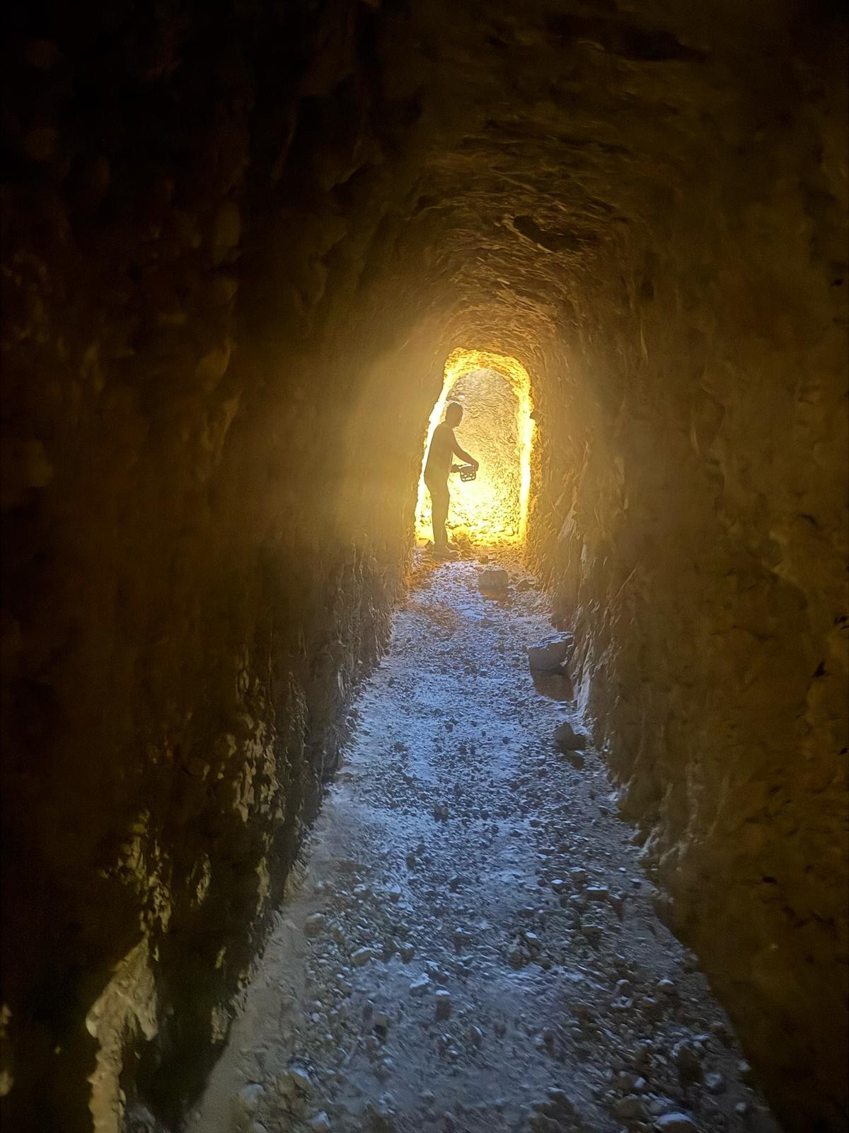
Mining at Rays occurred primarily between 1902 and 1909, led by the historic Mogul Mining Company, Rays Consolidated Mines, and related operators. Historic mining and development were concentrated in several principal areas, including Rays North, Priest, Range Front, Roosevelt, and Ibex, which together define the main mineralized corridor.
Historic mining and development were concentrated in several principal areas, including Rays North, Priest, Range Front, Roosevelt, and Ibex, which together define the main mineralized corridor.
Work completed during this period included:
- Multiple major vertical shafts greater than 500 ft vertical depth, numerous shafts < 300 ft
- Numerous adits and smaller shafts
- A principal development tunnel extending approximately 1,700 feet
- More than 7,000 feet of underground workings
Historic records and accounts describe high-grade gold and silver mineralization, visible gold in quartz veins, and sustained development activity, including the construction of a mining camp and plans for centralized processing. Reports indicate bonanza grades of gold & silver we3re shipped from 1902 onwards. Mining ceased prior to 1910, largely due to depressed economic and logistical constraints of the era and the diversion of capital to nearby discoveries at Tonopah and Goldfield.
No modern exploration drilling was ever conducted at Rays following this early period, leaving the system largely untested by contemporary methods.
Two Complementary Gold-Silver Systems
The Project hosts two distinct yet complementary gold–silver mineral systems within a single, contiguous land position:
Rays Project
Rays represents one of the most compelling exploration opportunities in the Tonopah region. Covering approximately 4,700 acres within the broader 5,300 acre Rays-West Dome land package, Rays hosts a large, structurally controlled orogenic gold–silver system supported by extensive historic underground mine development, strong modern geochemistry, and a robust geological framework—importantly, Rays has seen no modern drilling.
Rays provides exposure to a mineralized, deep-rooted gold system with clear structural controls, kilometre-scale continuity, and multiple parallel mineralized corridors, offering the potential for scale along strike and at depth.
West Dome Project
Adjacent to Rays, West Dome provides a complementary, drill-ready low-sulfidation epithermal gold–silver target style in the heart of Nevada’s Tonopah region. West Dome (referred to as “Fraziers Dome” in some historical and technical write-ups) comprises an approximately 700+ acre claim block immediately adjacent to the Rays Property and benefits from year-round access, nearby services, and an established exploration and mining workforce based in Tonopah (~12 km south).
Unlike Rays (which has no modern drilling), West Dome is supported by a meaningful modern dataset and a significantl historical drill database, offering Mogul multiple near-term discovery opportunities.
Geology
Ray's Project
The Rays Project hosts a district-scale orogenic gold–silver system defined by sub-parallel, north- to northwest-striking shear zones that together form a broad mineralized corridor. The three principal structures—the Rays, Voodoo, and Blackmont shears—are roughly parallel, spaced approximately 750 metres apart, and define a corridor exceeding 1.5 kilometres in width. Each shear has been mapped over multiple kilometres of strike length and hosts quartz veining, brecciation, alteration, and gold–silver mineralization. The Rays Shear contains the majority of historic underground workings and high-grade exposures, while the Voodoo and Blackmont shears demonstrate that mineralization extends across the full width of the corridor.
Mineralization at Rays is consistent with a classical orogenic gold system developed within Paleozoic metamorphic and sedimentary basement rocks, locally intruded by igneous bodies. Gold and silver occur within quartz veins and vein swarms, breccias and stockwork zones, and altered wall rock adjacent to major shear zones. Structural complexity—including bends, splays, intersections, and contrasts in host rock competency—plays a key role in localizing higher-grade mineralization, and the system is interpreted to be deep-rooted with strong potential for vertical continuity below historic workings.
Modern surface sampling has returned strong and locally high-grade gold–silver results, validating the historic high-grade nature of the system. Multi-gram gold values, including select samples exceeding 10 g/t gold, have been recovered from quartz veins and altered wall rock along the Rays Shear, while elevated gold–silver values along the Voodoo and Blackmont shears confirm mineralization across the corridor. Broad, coherent gold anomalies extend over kilometre-scale strike lengths and are commonly associated with zones of increased deformation, demonstrating that mineralization at Rays is widespread, structurally controlled, and continuous at surface.
West Dome Project
West Dome represents a classic Tonopah-style low-sulfidation epithermal gold–silver system hosted within a Tertiary volcanic and volcaniclastic sequence. The stratigraphy comprises volcanic flows, tuffs, and volcaniclastic sediments aged approximately 20.5 to 16 million years. The project lies within a district-scale basement–volcanic architecture, where older Paleozoic–Mesozoic basement rocks are overlain by younger volcanics. In places, this basement may occur at relatively shallow depths—an important consideration for identifying feeder structures and drill targets.
Mineralization at West Dome is strongly structurally controlled, with multiple vein orientations, including WNW and ENE trends. Intersections between these structures create dilation zones favorable for thicker veins, breccias, and higher-grade shoots, consistent with classical epithermal systems. Mogul’s recent mapping and data compilation have refined the structural model and highlighted several previously underappreciated structural corridors.
The mineralization style includes quartz veins and vein swarms, silicified breccias, stockwork zones, and associated clay alteration halos. Gold and silver are closely associated with zones of strong silicification, accompanied by typical epithermal pathfinders such as arsenic, antimony, and mercury, providing effective geochemical vectors for exploration.
Drilling & Exploration
Ray's Project
Mogul has advanced Rays through a systematic, modern exploration program to re-evaluate a historically productive but underexplored gold–silver district. Work completed includes detailed geological and structural mapping, over 1,000 soil and rock samples, UAV-borne magnetic surveys, and ground-penetrating radar, all integrated into a district-scale geological model. This work has defined a highly-mineralized, northwest-trending structural corridor exceeding 9 km in strike length, anchored by the Rays, Voodoo, and Blackmont shears—sub-parallel structures spaced approximately 750 metres apart and coincident with extensive historic underground development. Mapping and geochemistry confirm quartz-sulphide gold–silver lodes hosted in basement rocks, locally associated with copper, lead, zinc, antimony, and tungsten pathfinders, consistent with a large-scale orogenic gold–silver system .
Mogul has validated historic mineralization through underground access and modern sampling. Re-opening and mapping of the AP Adit confirmed continuity of mineralized structures along the Voodoo Shear, with underground and surface samples returning multi-gram to bonanza-grade gold values, including bulk samples exceeding 30 g/t Au, demonstrating coarse gold and favourable gravity recovery characteristics. Integration of underground mapping, surface geochemistry, and structural interpretation has led to the identification of multiple drill-ready targets focused on vertical lodes and shear intersections at Rays North, Rays Central, and along the Voodoo and Rays shears. These targets represent priority locations to test down-dip and along-strike extensions beneath historic workings, where mineralization remains open.
Exploration at Rays confirms the district-scale nature of the system and indicates that historic mining tested only a small portion of the broader mineralized corridor. Mogul has defined multiple drill-ready targets focused on vertically extensive lodes developed at the intersections of north-striking shears and northwest-trending regional structures. The scale and continuity of the parallel Rays, Voodoo, and Blackmont shears, together with strong gold–silver grades and a well-developed sulphide and pathfinder geochemical halo, support interpretation of a district-scale orogenic gold–silver system with meaningful depth potential. These features underpin a focused drill strategy targeting down-dip extensions and structural intersections beneath historic workings.
West Dome
West Dome has a history of prospecting and small-scale workings (adits/shafts) typical of the Tonopah district’s early mining era, followed by multiple phases of modern exploration beginning in the latter half of the 20th century. Since the late 1960s, various operators have explored West Dome for near surface, volcanic-hosted epithermal veins and lodes similar to other deposits in the Tonopah area.
The most important modern legacy is a substantial historical drilling database, comprising more than 37 reverse circulation and diamond drill holes completed primarily from the 1980s through the early 2000s. This drilling confirmed the presence of an epithermal gold–silver system, but it was generally focused on shallow targets and did not systematically test the broader structural corridor or deeper/high-confidence intersection targets now being refined by Mogul.
Mogul has materially advanced the West Dome technical foundation by integrating historical data with new fieldwork and modern interpretation. This work includes detailed geological mapping, comprehensive geochemical sampling, and digitization of historic data into a modern GIS and 3D-targeting framework. Multiple priority targets have been defined, including a newly emphasized altered structural corridor characterized by strong alteration and silicified breccias, expanding the project’s exploration potential beyond the limits of earlier drilling.
Mogul’s exploration work has confirmed a well-preserved epithermal gold–silver system hosted near the volcanic–basement contact, and has outlined multiple high-priority drill targets defined along major vein systems and structural intersections. Historic drilling was shallow and did not test the system at depth, leaving potential for a larger gold system beneath historic workings. Alteration, geochemical vectors, and the presence of reactive carbonate units indicate potential for strengthening mineralization at depth and introduce the possibility of Carlin-style gold mineralization, positioning West Dome as a compelling brownfields discovery opportunity.
argentina
San Francisco De Los Andes
One of the highest-grade gold-copper tourmaline breccias ever discovered
The San Francisco de Los Andes breccia is one of the highest-grade tourmaline breccias ever discovered. Limited shallow drilling and channel sampling returned spectacular grades of 2-12 g/t gold and 0.3 to 3% copper over 20-40 m intervals. The mineralogy and geological setting indicates that only the top of the breccia pipe has been exposed, with excellent potential for growth at depth and laterally. Furthermore, San Francisco de Los Andes is only one of over 60 breccia bodies mapped to date on the property.
San Francisco is located in San Juan, Argentina: a pro-mining state which has defined Mining Development as a Key State Policy. San Juan is home to 12 mines in operation, 5 in construction and 20 in pre-feasibility/feasibility stage (Figure 1).The San Francisco project is located in arid hills on the eastern margin of the Andes mountain range at a moderate elevation of 2600m. The project has well-developed infrastructure, being located 24 km from high voltage powerlines and 30 km by unpaved road to the township of Villa Nueva. The local community of Calingasta (population 8000) supports the nearby Casposo gold mine (Austral Gold) and welcomes new exploration efforts in the region.
Intermittent small-scale mining at the San Francisco mine from 1941 to 1980 produced 2420 tons of material grading 6-7% copper and 1.43% bismuth. Compania Minera Aguilar evaluated the San Francisco mine in the 1980’s, through underground development, mapping, sampling and drilling. Intersections resampled by Turmalina Metals include:
- 39.9m @ 3.8 g/t Au & 1.1 % Cu
- 40.3m @ 4.9 g/t Au & 0.8 % Cu
- 31.7m @ 3.1 g/t Au & 1.0 % Cu
- 57.1m @ 2.0 g/t Au & 0.4 % Cu
Historic sampling of the underground workings returned:
- 51m @ 4.8 g/t Au, 0.69 g/t Ag, 0.6 % Cu & 0.78% Pb
- 20m @ 12.0 g/t Au, 119 g/t Ag, 2.5 % Cu & 0.16 %Pb
- 41m @ 8.1 g/t Au, 143 g/t Ag, 3.67 % Cu & 0.31 % Pb
- 23m @ 9.0 g/t Au, 16 g/t Ag, 0.27 % Cu & 0.13 % Pb
Regional exploration in the 1990’s by Crown Resources, including geochemical sampling, IP and 5 shallow drill holes on regional targets, focused on evaluating the porphyry potential of the project, rather than the tourmaline breccias. Exploration by Petra during 2005-2008 included the drilling of 7 shallow holes, focused on testing porphyry and vein targets in the area. The best result for this drilling was 33m @ 0.7% Cu for a tourmaline breccia target in the north of the project area.
The geology of San Francisco consists of Late Permian diorite, granodiorite and quartz monzonite (the Colanguil Batholith) emplaced into the Carboniferous-Permian quartzites and shales of the Aqua Negra formation. The Colanguil Batholith is part of a regional magmatic suite that is known to host porphyry-style copper and tourmaline breccia polymetallic mineralisation. Both the intrusions and the surrounding sediments are cut by tourmaline breccia pipes, quartz veins, andesite dykes and rhyolite dykes.
Mineralisation at the project is hosted in both numerous copper-gold-silver-molybdenum-lead-zinc-bismuth mineralised tourmaline breccia pipes, and in gold-silver-copper mineralised quartz veins. The top 20-40 meters of the breccia pipes are typically oxidised and leached, with an underlying 20 to 40m thick supergene zone and deeper primary sulphide mineralisation. At the San Francisco mine the primary breccia is composed of quartzite clasts set in a 5 to 30% tourmaline-quartz-pyrite-arsenopyrite-chaclopyrite-galena-sphalerite matrix.
Exploration by previous companies has identified over 60 tourmaline breccia on the property, many of them unsampled. Our first stage of exploration at the project aims to systematically map, sample and prioritize these breccias, while extending mineralisation at the San Francisco breccia pipe.
Tourmaline breccia pipes are typically characterized by an ‘inverted carrot’ geometry, with diameter increasing with depth, and individual pipes can have vertical extents in excess of 1500m. The geology and morphology of the San Francisco breccia suggests the exposed breccia is located at the very top of a breccia pipe, with the probable extension at depth presenting a compelling drill target to be tested by Turmalina Metals.
San Francisco Project area
PERU
The Chanape Project
Multiple high-grade tourmaline Au-Ag-Cu breccia pipes, with 30 breccia zones identified to date.
The Chanape project contains several strongly mineralized tourmaline breccia pipes that are clustered around a large mineralized copper-molybdenum intrusion. Historical drill holes have confirmed mineralization on breccia pipes and recent surface geological mapping have added new mineralized bodies for follow-up (E.g. San Antonio Breccia: 18m @ 3.47 g/t Au, 305 g/t Ag, 0.3% Cu, 1.3% Pb Channel Sample D).
The Chanape Project is located in the Western Cordillera of Central Peru, about 87 direct kilometres east-northeast of the capital City of Lima. Chanape is centered at about Latitude 11°55’23”S and Longitude 76°15’49”W (WGS84 UTM Zone 18L, 362400mE, 8681630mS) with an average of 4,650m AMSL.
The project is situated 24km away via unpaved road from San Damian village, where Local Community of Checa is based and with whom Aurora Copper Perú has a registered agreement for use and ease of the land where Chanape Project is located.
The Chanape area has been explored since the colonial period, but extensive exploration and small-scale mining development began in 1950. The most recent exploration program including drilling was completed by High Ridge (2007-2009),who drilled 10 holes (2,352m) and Inca Minerals Limited (2010-2015), with 33 holes and a total of 9,746m. Aurora Copper Peru/Turmalina Metals Corp.’s reviewed the data available in 2019, and in 2020 signed an exploration agreement with an option to purchase for the property. Best results obtained in the property so far are intersections in high grade Cu-Au-Ag quart tourmaline breccias that included: a mineralization that included:
- Clint Breccia: 71m @ 1.92 % Cu, 0.81 g/t Au & 41 g/t Ag (sulphide, CHDDH013)
- Clint Breccia: 55m @ 2.25 % Cu, 0.57 g/t Au & 42 g/t Ag (sulphide, CHDDH012)
- Breccia 8: 108m @ 1.98 g/t Au & 41 g/t Ag (Cu-leached oxide zone, CHDDH001)
- Breccia 11: 150m @ 0.47 g/t Au & 4 g/t Ag (Cu-leached oxide zone, CHDDH002)
- Breccia 11: 62m @ 0.61 g/t Au & 5 g/t Ag (Cu-leached oxide zone, CHDDH003).
These intersections shows several strongly copper-gold-silver mineralised tourmaline breccia pipes that are clustered around large copper-molybdenum mineralised intrusions. High grade mineralisation in all these breccias remains open along strike and at depth. Two historic holes drilled into the ~1.5 km by 0.75 km wide mineralised intrusive body (the “Chanape Igneous Complex”) in the centre of the Chanape breccia cluster intersected broad zones of moderate
copper-molybdenum mineralisation with grades typical of primary (‘hypogene’) porphyry mineralisation in Peru (i.e. Chanape Porphyry: 284m @ 0.32% Cu and 83 ppm Mo; CHDDH011). With only limited drilling into this intrusive complex there remains strong potential for the discovery of further mineralised intrusions.
In addition to the historic drilling the Company’s 2021 mapping program at the Project has so far identified over 20 tourmaline breccias, with at least six breccia pipes returning Cu-Au-Ag grades similar or better than surface grades at the historically drilled breccias or to those found thus far at the Company’s high-grade San Francisco project in Argentina (i.e. Chanape rock chips of up to 35 g/t Au and 89 g/t Ag in Cu-leached oxidised samples).
The prolific Central Peru belt, which extends to northern Peru, is paralleling the Pacific coast, roughly coinciding with the Andes Mountains and hosts several mines and projects. Au-Ag-Cu Chanape project occurs within the Miocene metallogenetic belt, like many Peruvian world-class deposits.

Typically, quartz-tourmaline breccia pipes can extend over 2 or 3 km in depth in a porphyry system: as in Rio Blanco – Los Bronces mine (Warnaars, F. et al 2005) and Cabeza de Vaca (Sillitoe and Sawkins, 1971) in Chile, and Cerro Verde mine (Quang, Ch. et al 2003) in Peru.
In Chanape, many intrusive rocks (i.e., quartz diorite porphyry, monzodiorite porphyry and dacite porphyry) were recognized cutting the Millotingo and Pacococha formations (tertiary volcanic rocks); and hosting polymetallic veins (Ag-Au-Zn-Pb-Cu), Au-Ag-Cu tourmaline breccia pipes, and a possible deep Cu-Mo porphyry target. In general, precious metals and polymetallic mineralization within a breccia pipe is typically uniform throughout the top of the breccias (the ‘roof’) while at greater depths the breccia pipe widens with Cu-Ag-Mo higher-grade mineralization becoming focused along the margins and ends (‘lobes’) in intrusion-related breccia pipes (Kirwin, D. 1985). In that order, previous works in Chanape (Inca Minerals) identified a classical vertical zonation: Cu-Ag-Mo-Au bottom portion, an intermediate Au-Ag-Cu-Mo, and an upper Zn-Pb-Ag-Au-Cu portion. Similar to other ore deposits as San Francisco de los Andes project in Argentina (Kirwin, D. 2018) and Soledad project in Peru (Kelley, D. et al 2019).


